Enviro News Asia, Jakarta — High-confidence thermal hotspots across Indonesia recorded a significant national decline on September 7, 2026. According to latest data from the Ministry of Forestry’s (Kemenhut) SiPongi monitoring system, 386 high-confidence hotspots were detected nationwide, representing a sharp decrease of 288 points compared to 674 hotspots recorded on September 6. Across the six priority provinces, sharp reductions were primarily observed in Central Kalimantan and West Kalimantan, while South Sumatra emerged as the province with the highest hotspot count, prompting intensified field operations.
Based on SiPongi data sourced from NASA Terra/Aqua, SNPP, and NOAA-20 satellites on Monday, September 7, 2026, at 9:20 PM WIB, high-confidence hotspots across the six priority provinces were distributed as follows:
- South Sumatra: 88 points;
- Central Kalimantan: 46 points;
- West Kalimantan: 31 points;
- Riau: 10 points;
- South Kalimantan: 4 points; and
- Jambi: 4 points.
Central Kalimantan and West Kalimantan recorded steep single-day declines, dropping by 197 points and 107 points respectively. Decreases were also recorded in Jambi and South Kalimantan, contributing directly to the overall national reduction.
Conversely, South Sumatra recorded 88 high-confidence hotspots, the highest among the six priority provinces during the latest observation cycle. This shift has led authorities to intensify operational focus in South Sumatra while maintaining full vigilance across other priority regions.
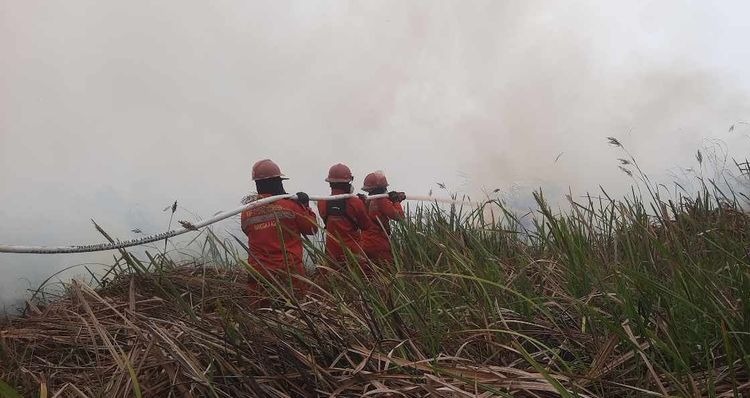
The Ministry emphasized that satellite hotspots indicate surface temperature anomalies rather than individual confirmed fires, as one fire event can trigger multiple hotspot readings. Consequently, all satellite indications undergo verification through ground checks and actual site monitoring. Kemenhut’s Manggala Agni firefighters alongside the Military (TNI), National Police (Polri), BNPB, BMKG, BPBD, local governments, private concessionaires, communities, and other partners continue ground patrols, ground checks, direct suppression, firebreak construction, mopping up, cooling, and monitoring of areas prone to reignition.
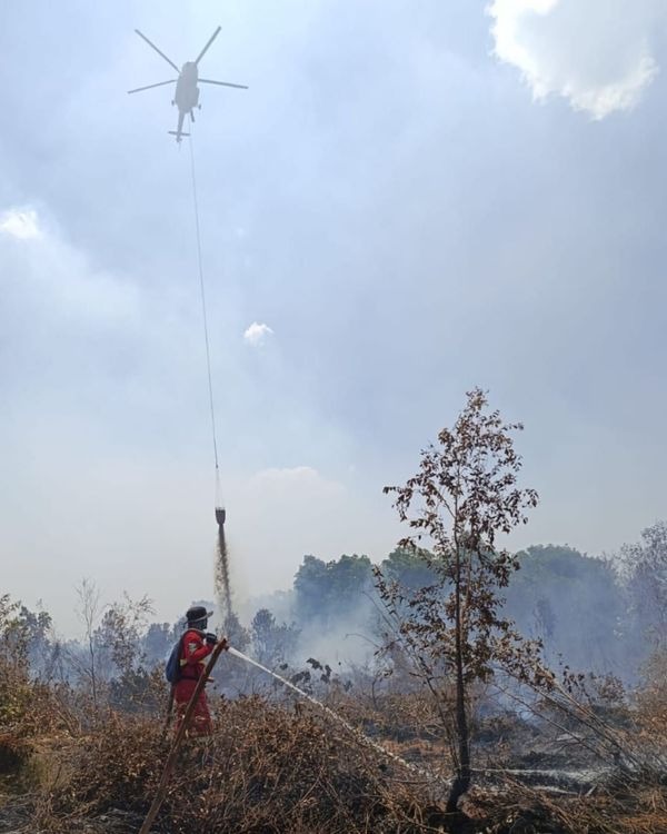
To reinforce ground personnel, the government maintains 53 aerial fleet units across the six priority provinces (Riau, Jambi, South Sumatra, South Kalimantan, Central Kalimantan, and West Kalimantan). Of this fleet, 19 aircraft are allocated for air patrols and Weather Modification Technology (OMC) operations, while 34 aircraft are dedicated to water-bombing. Air operations and OMC cloud-seeding are continuously adapted to field needs and meteorological conditions to assist land rewetting and fire containment.
Alongside fire suppression, the government actively monitors PM2.5-based air quality. Current monitoring indicates varied air quality across the country; while several areas in Sumatra and Kalimantan record unhealthy to very unhealthy levels, the majority of Indonesian regions remain within good to moderate categories.
BMKG aviation weather observations on Tuesday morning, September 8, 2026, revealed persistent haze affecting visibility across key priority locations:
- Pontianak: approximately 1.7 kilometers, hazy/smoky;
- Palembang: approximately 3.3 kilometers, hazy/smoky;
- Palangka Raya: approximately 4 kilometers, hazy/smoky;
- Pekanbaru: approximately 4 kilometers, hazy/smoky;
- Jambi: approximately 6 kilometers, partly cloudy; and
- Banjarmasin: approximately 9 kilometers, partly cloudy.
Conditions in Palembang have drawn close attention due to the surge in high-confidence hotspots in South Sumatra, with BMKG recording visibility of 3.3 kilometers amid smoky conditions at 8:00 AM WIB. Meanwhile, visibility in Pontianak, West Kalimantan, dropped to 1.7 kilometers due to haze.
Authorities note that visibility shifts rapidly following smoke density, fire activity, wind speed and direction, humidity, rainfall, and atmospheric dynamics. The Ministry of Forestry continuously integrates hotspot data, field fire conditions, air quality, haze dispersion, weather forecasts, rainfall, and visibility to determine operational priorities and resource allocation. (*)