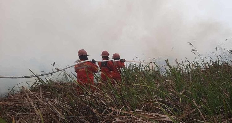
Enviro News Asia, Jakarta — Recent satellite data from the Ministry of Forestry (Kemenhut) indicates a positive trend in South Sumatra, where high-confidence thermal hotspots dropped nearly by half compared to the previous day. Despite this improvement, the Ministry and joint task forces continue to reinforce forest and land fire (karhutla) control operations across six priority provinces, with particular focus on Central Kalimantan and West Kalimantan due to rising hotspot concentrations.
Based on Kemenhut’s SiPongi monitoring system using NASA Terra/Aqua, SNPP, and NOAA-20 satellites, 674 high-confidence hotspots were detected nationwide on Sunday, September 6, 2026, at 9:25 PM WIB, marking an increase from 558 points on September 5. Across the six priority provinces, high-confidence hotspots were recorded as follows:
- Central Kalimantan: 243 points;
- West Kalimantan: 138 points;
- South Sumatra: 61 points;
- Jambi: 26 points;
- South Kalimantan: 20 points; and
- Riau: 7 points.
The reduction in South Sumatra represents a decrease of 59 hotspots, or approximately 49 percent, within a single day, alongside drops in Riau. However, hotspot increases in Central Kalimantan and West Kalimantan have made both provinces the primary focus for intensified patrols, ground checks, direct suppression, and containment operations to prevent fires from spreading.
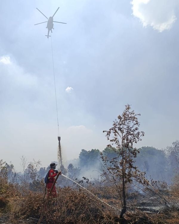
The Ministry emphasized that satellite hotspots indicate surface temperature anomalies rather than confirmed individual fires, as one fire event can trigger multiple hotspot readings. Consequently, every satellite indication undergoes field verification through ground checks and direct site monitoring. Suppression operations are continuously executed by Kemenhut’s Manggala Agni firefighters alongside the Military (TNI), National Police (Polri), BNPB, BMKG, BPBD, local governments, private concessionaires, communities, and other partners through direct firefighting, firebreak construction, mopping up, cooling, and re-ignition prevention.
To reinforce ground crews, the government maintains 53 aerial fleet units across the six priority provinces (Riau, Jambi, South Sumatra, South Kalimantan, Central Kalimantan, and West Kalimantan). Of this fleet, 19 aircraft are deployed for air patrols and Weather Modification Technology (OMC) operations, while 34 aircraft are dedicated to water-bombing. OMC operations are continuously conducted whenever meteorological conditions permit to raise soil moisture and assist ground containment.
Alongside field operations, the government tracks PM2.5-based air quality. On September 6, air quality remained varied; while most of Indonesia enjoyed good to moderate air quality, several areas in Kalimantan and Sumatra registered unhealthy to very unhealthy levels, with certain zones reaching hazardous conditions.
BMKG aviation weather observations on the night of September 6 recorded varying visibility levels across key provincial capitals:
- Pontianak: approximately 2 kilometers, hazy/smoky;
- Palangka Raya: approximately 8 kilometers, cloudy;
- Banjarmasin: approximately 9 kilometers, partly cloudy;
- Palembang: 10 kilometers or more, cloudy;
- Jambi: approximately 7 kilometers, cloudy; and
- Pekanbaru: approximately 8 kilometers, partly cloudy.
Conditions in Pontianak remain a priority concern due to persistent haze reducing visibility to 2 kilometers, whereas visibility in other priority capitals remained relatively better during observation. Authorities note that visibility fluctuates rapidly based on smoke concentration, fire intensity, wind speed, humidity, rainfall, and atmospheric dynamic.(*)