


Enviro News Asia, Jakarta — Indonesia recorded a sharp increase in high-confidence fire hotspots on Nov. 5, with the national total rising to 338 from 215 a day earlier, as the Forestry Ministry stepped up firefighting efforts in Central Kalimantan, the province hardest hit by the latest surge.
Data from the ministry’s SiPongi monitoring system showed that hotspots across six priority provinces for forest and land fire control increased from 41 to 86. Central Kalimantan accounted for 85 detections, while South Kalimantan recorded one. Jambi, West Kalimantan, South Sumatra and Riau reported no high-confidence hotspots.
The increase was concentrated in Central Kalimantan, where detections climbed from 37 to 85 in one day. The ministry said the development required stronger patrols, field inspections, firefighting operations and efforts to rewet fire-prone areas, particularly peatlands that can retain underground embers.
The ministry cautioned that satellite-detected hotspots indicate surface temperature anomalies identified by NASA Terra/Aqua, SNPP and NOAA-20 satellites. They do not directly represent the number of fires or the area burned, and must be verified through field inspections.
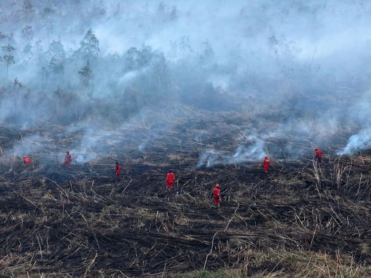
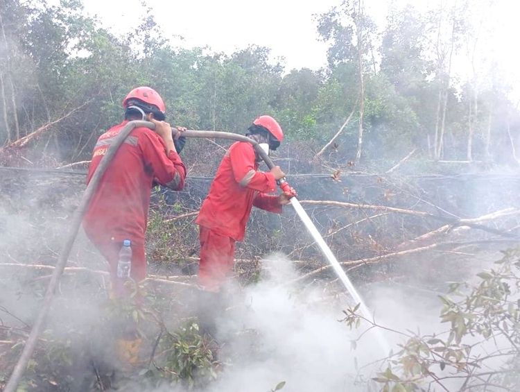
Field reports from Nov. 5 showed that firefighting operations were still under way in Tanjung Taruna and Jabiren in Pulang Pisau regency, Central Kalimantan. Heavy smoke remained visible in Tanjung Taruna, while fires in Jabiren had yet to be fully extinguished. Both sites involved surface and underground peat fires.
In South Sumatra, crews continued to battle fires in Pulau Geronggang and Talang Rimba in Ogan Komering Ilir regency, despite the absence of high-confidence hotspot detections. Fires in Talang Rimba remained active and required further suppression, while the fire in Pulau Kabai, Ogan Ilir regency, had been declared extinguished.
Forestry Minister Raja Juli Antoni travelled to Central Kalimantan on Nov. 5, arriving at Iskandar Airport in Pangkalan Bun to receive direct briefings on the firefighting response and a military helicopter accident during an aerial water-bombing mission.
An Indonesian Army Mi-17V5 helicopter crashed on Nov. 4 while conducting water-bombing operations near Tanjung Puting National Park. Raja Juli expressed condolences for the crew members who died during the humanitarian mission and said survivors should receive the best possible medical care.
His visit was intended to ensure that firefighting operations continued despite the rising hotspot count. He also underscored the need for close coordination between the Forestry Ministry, the military, police, the National Disaster Mitigation Agency (BNPB), local governments and other agencies, including measures to protect personnel involved in field operations.
Fire suppression efforts were also continuing elsewhere. In East Kalimantan, crews were still battling a fire in Sepaso Timur village, East Kutai regency, where the blaze had not been fully extinguished as of the latest report.
The ministry said its Manggala Agni fire crews were working alongside BNPB, the military, police, the Meteorology, Climatology and Geophysics Agency (BMKG), regional disaster agencies, local governments, community fire groups, businesses and volunteers.
Their operations include patrols, field verification, direct firefighting, peatland rewetting, searches for remaining embers, mop-up operations and cooling efforts, depending on conditions at each site.
The ministry stressed that the increase to 338 hotspots, particularly the sharp rise in Central Kalimantan, warranted heightened vigilance. However, satellite readings must be assessed alongside field findings. The absence of detected hotspots does not necessarily mean a fire has been extinguished, while an increase in detections cannot automatically be interpreted as a rise in fire incidents or burned area. (*)