


Enviro News Asia, Jakarta — Indonesia recorded 215 high-confidence forest and land fire hotspots on Nov. 4, 2026, up 133 from the previous day, prompting the Forestry Ministry to strengthen patrols and suppression efforts, particularly in Central Kalimantan, where detections rose sharply.
Data from the ministry’s SiPongi monitoring system, based on NASA Terra/Aqua, SNPP and NOAA-20 satellite observations at 9 p.m. local time, showed that hotspots across six priority provinces increased from 35 to 41.
Central Kalimantan recorded 37 hotspots, followed by South Kalimantan with three and Jambi with one. No high-confidence hotspots were detected in West Kalimantan, South Sumatra or Riau.
The most significant change occurred in Central Kalimantan, where the number rose from one to 37. In contrast, Jambi recorded a decline from 25 to one, while South Sumatra fell from six to zero and West Kalimantan from three to zero.
The Forestry Ministry emphasized that satellite hotspots indicate surface temperature anomalies and do not directly represent the number of fires or the total burned area. Authorities must verify satellite detections through patrols and on-site inspections.
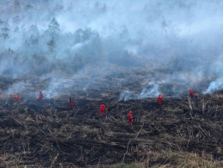
The distinction was evident in South Sumatra. Although the latest monitoring detected no high-confidence hotspots, the ministry’s Forest Fire Control Command Post reported continued suppression operations on Nov. 4 in Talang Rimba and Pulau Geronggang, Ogan Komering Ilir district. Both sites are peatland areas experiencing underground fires that require further suppression.
In Central Kalimantan, joint teams continued mop-up operations and inspections in the Sei Sekonyer–Tanjung Harapan area of Tanjung Puting National Park. Crews checked access routes, gathered firefighting equipment and re-examined previously burned areas. The latest field report classified conditions at the site as safe.
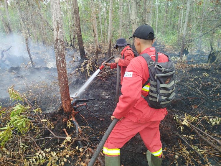
The increase to 37 hotspots in Central Kalimantan has prompted Manggala Agni firefighting teams and other agencies to heighten vigilance. Peatland fires can persist and spread beneath the surface, making patrols, field inspections, rewetting, mop-up operations and cooling essential to prevent fires from reigniting.
Progress was also reported elsewhere. Manggala Agni teams fully extinguished a fire in Tasuk Village, Berau district, East Kalimantan. A fire in Tabarano Village, Poso district, Central Sulawesi, was also declared extinguished.
Aerial operations and weather modification activities will continue to be adjusted according to conditions in each region. The government has evaluated its integrated weather modification operations and will maintain interventions based on atmospheric conditions, cloud formation potential and local fire-control requirements.
Manggala Agni teams are working alongside the National Disaster Mitigation Agency (BNPB), the Indonesian Military, the National Police, the Meteorology, Climatology and Geophysics Agency (BMKG), regional disaster management agencies, local governments, community fire groups, businesses and volunteers.
Their activities include patrols, field inspections, direct firefighting, firebreak operations, peatland wetting, searches for residual embers, mop-up operations and cooling.
The Forestry Ministry said the rise to 215 hotspots required increased vigilance, but satellite figures must always be assessed alongside field verification. The absence of detected hotspots does not necessarily mean fires have been fully extinguished, while an increase in detections cannot automatically be interpreted as a rise in fire incidents or burned area. (*)