Enviro News Asia, Jakarta — The number of high-confidence hotspots detected across Indonesia fell by 260 points on September 5, 2026, although the Ministry of Forestry (Kemenhut) is maintaining intensified forest and land fire (karhutla) control operations, particularly in South Sumatra.
According to the Ministry’s SiPongi monitoring system, 558 high-confidence hotspots were detected nationally on September 5, down from 818 points recorded the previous day.
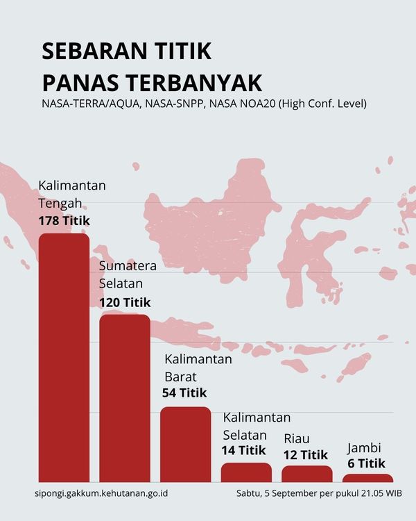
The data, sourced from NASA Terra/Aqua, SNPP, and NOAA-20 satellites, showed that five of six priority provinces recorded declines in high-confidence hotspots. Central Kalimantan recorded the highest number with 178 points, followed by South Sumatra with 120.
Other priority provinces recorded 54 hotspots in West Kalimantan, 14 in South Kalimantan, 12 in Riau, and six in Jambi.
The Ministry emphasized that hotspots represent indications of surface-temperature anomalies detected by satellites and do not necessarily correspond to individual fires. A single fire event may generate multiple hotspot detections, making field verification and ground checks essential.
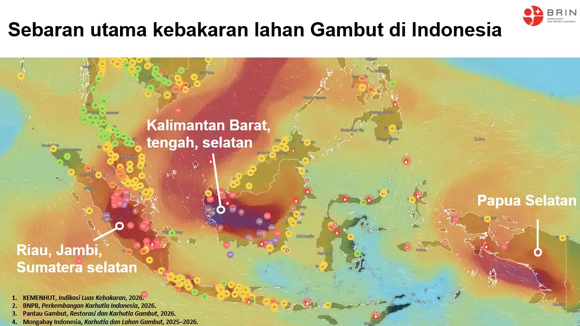
Despite the overall decline, the government has maintained heightened attention in South Sumatra, where 120 high-confidence hotspots were still detected on September 5.
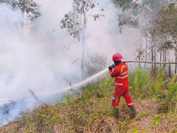
Joint teams comprising Manggala Agni personnel, the Indonesian Military (TNI), National Police (Polri), National Disaster Management Agency (BNPB), Meteorology, Climatology and Geophysical Agency (BMKG), regional disaster agencies, local governments, communities, businesses, and other stakeholders are continuing patrols, ground checks, direct firefighting, firebreak operations, mopping-up, and cooling activities.
The teams are also monitoring areas that have already been treated to ensure that fires do not reignite.
Rain Helps Reduce Hotspots in West Kalimantan
West Kalimantan recorded one of the most significant improvements following moderate to heavy rainfall in parts of the province on the night of September 4.
High-confidence hotspots in the province fell from 124 on September 4 to 54 on September 5, a decline of 70 points.
The rainfall helped increase soil moisture and support ongoing fire suppression efforts. However, the Ministry cautioned that rainfall has not been evenly distributed across the province, while smoke remains visible in several locations.
Continued wetting, mopping-up operations, patrols, and field checks remain necessary, particularly in peatland areas where fires can persist beneath the surface.
Despite the decline in hotspot numbers, visibility remained a concern in parts of West Kalimantan. BMKG recorded visibility of approximately two kilometers in Pontianak under smoky conditions on the night of September 5, while Putussibau recorded smoky conditions with visibility of around one kilometer.
53 Aircraft Deployed
The government has deployed 53 aircraft to support forest and land fire control operations across six priority provinces: Riau, Jambi, South Sumatra, South Kalimantan, Central Kalimantan, and West Kalimantan.
Of the total, 19 aircraft are being used for aerial patrols and to support Weather Modification Operations (OMC), while 34 aircraft are assigned to water-bombing operations.
The deployment of aerial resources is adjusted according to field conditions and operational requirements. Weather modification efforts are also being pursued in areas and periods with suitable meteorological conditions to increase rainfall, support land wetting, and strengthen fire-control operations.
In addition to monitoring hotspots and fire activity, authorities are closely tracking air quality, smoke distribution, weather conditions, and visibility to determine operational priorities and measures to protect communities.
BMKG’s PM2.5-based air-quality monitoring showed varying conditions across affected areas. Some parts of Sumatra and Kalimantan remained in the unhealthy to very unhealthy categories, while many other parts of Indonesia remained in the good to moderate categories.
Visibility conditions also fluctuated rapidly depending on fire activity, wind, humidity, and atmospheric conditions.
At Sultan Mahmud Badaruddin II Airport in Palembang, South Sumatra, visibility fell to around five kilometers under smoky conditions during the afternoon of September 5 before improving to 10 kilometers or more under cloudy conditions that night.
The Ministry of Forestry said integrated monitoring of hotspots, field fire conditions, rainfall, air quality, smoke distribution, weather, and visibility would continue to guide the deployment of personnel and ground and aerial operations.
The government has also urged communities not to clear or prepare land by burning. Residents in smoke-affected areas are encouraged to monitor official information on air quality, weather, and visibility and adjust outdoor activities when conditions deteriorate.
The Ministry has called on residents who detect smoke, fire points, or signs of forest and land fires to report them immediately so authorities can respond at an early stage. (*)