Enviro News Asia, Jakarta — Indonesia has intensified efforts to control forest and land fires in Central Kalimantan, with the Ministry of Forestry, the National Disaster Management Agency (BNPB) and joint response teams strengthening both aerial and ground operations.
Forestry Minister Raja Juli Antoni and BNPB Head Lt. Gen. Suharyanto are directly overseeing the response, including weather modification operations, ground task force activities and fire command posts.
According to Forestry Ministry SiPongi data based on NASA Terra/Aqua, SNPP and NOAA-20 satellite observations, Indonesia recorded 932 high-confidence hotspots as of September 22 at 9:20 p.m. local time, an increase of 244 from 688 hotspots recorded the previous day.
Among six priority provinces, Central Kalimantan recorded 643 high-confidence hotspots, up from 228. West Kalimantan also increased from 36 to 50 hotspots.
South Kalimantan recorded 68 hotspots, down from 71, while South Sumatra declined from 23 to 17. Jambi recorded zero hotspots, down from two, while Riau remained at zero.
Central Kalimantan continued to record the highest number of high-confidence hotspots among the six priority provinces.
The Forestry Ministry emphasized that hotspots represent satellite-detected surface temperature anomalies and cannot automatically be equated with individual fire incidents or the total area burned. A single fire can generate multiple hotspot detections, making ground verification and field conditions essential to determine the actual situation.
Minister Monitors Weather Modification Operations
On September 22, Raja Juli and Suharyanto monitored weather modification operations at the Tjilik Riwut Airport OMC Command Post in Palangka Raya.
The monitoring focused on meteorological conditions, potential cloud development, aircraft readiness and efforts to increase moisture in fire-prone areas.
Weather modification operations are among the measures used to support fire management, particularly to increase rainfall or wetting in peatland ecosystems. Their implementation depends on the availability of suitable clouds and aviation conditions.
The two officials later visited the Central Kalimantan Regional Disaster Management Agency’s operations center to evaluate the ground task force, including fire developments, firefighting operations, personnel and equipment deployment, and challenges faced by teams in the field.
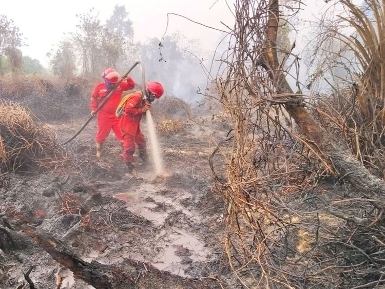
Ground operations remain critical when heavy smoke and low visibility restrict helicopter water-bombing activities.
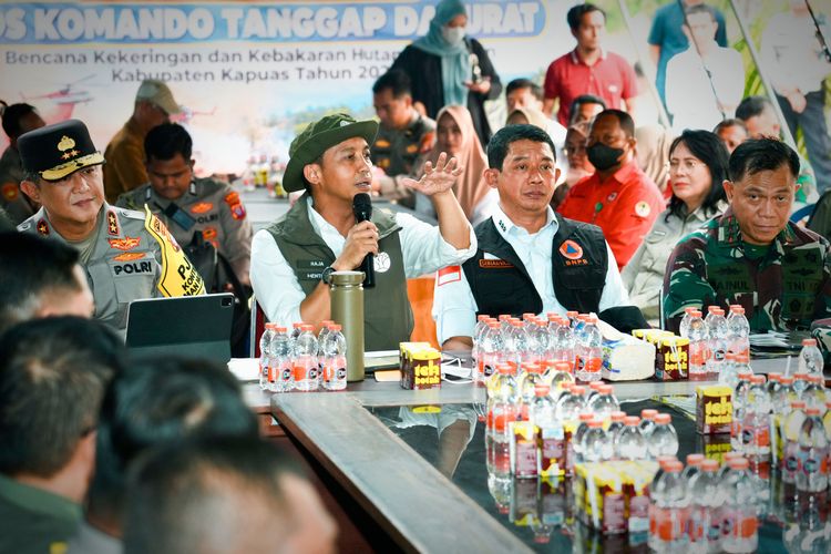
In the afternoon, the officials visited the fire command post in Kapuas Regency and coordinated with the local government and other agencies. The meeting involved the Kapuas regent, the Central Kalimantan police chief, the commander of the XII/Tanjungpura Military Command and other relevant authorities.
The direct monitoring has been conducted since September 21 to shorten coordination chains and ensure that aerial and ground operations can be adjusted to changing conditions.
61 Aircraft Support Fire Operations
The government has deployed 61 aircraft to support forest and land fire response operations. Seventeen aircraft are assigned to patrols and weather modification operations, while 44 are deployed for water bombing.
Aircraft deployment is adjusted according to fire locations, cloud potential, wind direction, smoke conditions, visibility and aviation safety.
On the ground, the Forestry Ministry’s Manggala Agni fire brigade is working with BNPB, the military, police, regional disaster agencies, local governments, communities, volunteers, businesses and other stakeholders.
Their activities include patrols, ground checks, direct firefighting, fire containment, wetting, mopping up and cooling operations.
Cooling remains necessary even after visible flames have disappeared in peatland areas because underground embers can persist and reignite when conditions become dry.
Air Quality Remains a Concern
PM2.5 monitoring shows varying air quality conditions across Indonesia. Most areas remain within good to moderate categories, while several locations in Sumatra and particularly Kalimantan continue to experience unhealthy to very unhealthy conditions, with some areas reaching hazardous levels.
The government is therefore monitoring more than hotspot numbers, including ground fire conditions, PM2.5 concentrations, smoke distribution, humidity, wind direction, rainfall potential and visibility.
The Meteorology, Climatology and Geophysics Agency (BMKG) has also forecast potential Cumulonimbus cloud development in parts of Sumatra and Kalimantan from September 23 to 29, including Central Kalimantan, West Kalimantan, South Kalimantan, Riau, Jambi and South Sumatra.
The forecast is being used as one of the considerations for aerial firefighting and weather modification operations.
Public Vigilance Urged
The Forestry Ministry has urged people in affected areas to monitor air quality information and follow guidance from local authorities. When air quality deteriorates, residents are advised to reduce outdoor activities and wear masks when outdoor activities are unavoidable.
Children, pregnant women, older people and individuals with respiratory disorders or chronic illnesses require particular attention during periods of poor air quality.
The government also reminded communities and businesses not to clear or open land by burning. Area managers are required to ensure that personnel, firefighting equipment, early detection systems and fire-control mechanisms are operational and ready.
Residents who detect smoke, fires, burning activities or wildlife affected by fires are encouraged to report the situation immediately so that authorities can respond at an early stage. (*)