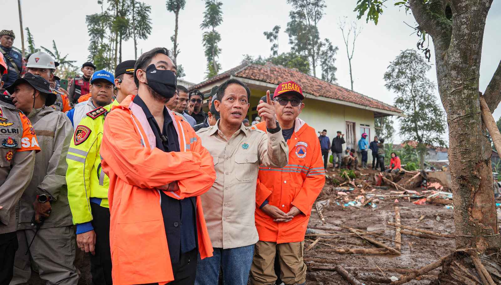
Enviro News Asia, West Bandung — Indonesia’s Minister of Environment and Head of the Environmental Control Agency (KLH/BPLH), Hanif Faisol Nurofiq, stated that environmental recovery and comprehensive landscape spatial planning reform must become top priorities following the landslide in Pasirlangu Village, Cisarua District, West Bandung Regency.
During a site visit on Sunday, the Minister emphasized the need to strengthen environmental carrying and capacity functions to ensure ecological sustainability amid ongoing land-use activities. The visit formed part of the government’s rapid response to identify environmental factors that pose risks to public safety in the area.
Minister Hanif underlined that disaster management must go beyond emergency response and be grounded in comprehensive scientific assessments. KLH/BPLH will deploy a multidisciplinary team of experts to conduct an in-depth evaluation of the landslide’s root causes, particularly those linked to extensive land-use change. The assessment aims to support the formulation of stricter spatial planning policies to prevent similar incidents in the future.
“Disaster management cannot be handled in a fragmented manner. We will involve experts to examine the main causes of this landslide and formulate follow-up measures, especially in relation to spatial planning, to ensure such incidents do not recur,” Hanif said at the site.
Data from the Meteorology, Climatology, and Geophysics Agency (BMKG) show that Cisarua experienced rainfall for four consecutive days, with an average intensity of 68 millimeters per day. While rainfall acted as a trigger, the Minister noted that the level was not considered extreme compared to other regions, such as parts of Sumatra, which experience higher rainfall but maintain stronger landscape resilience. This suggests underlying vulnerability in land cover conditions in West Bandung.
“This rainfall intensity, while a trigger, is not particularly high compared to other disaster-prone areas. This indicates the presence of other contributing factors that must be thoroughly evaluated,” he explained.
Additional factors are believed to include geological conditions, steep slopes, and land clearing for community agriculture that does not follow sustainable environmental management principles. The Minister highlighted discrepancies between land use and the area’s environmental carrying capacity, noting that declining vegetation cover due to land conversion without proper terracing or reinforcement has increased the risk of soil movement during rainfall.
Minister Hanif stressed that unsustainable land-use practices significantly heighten disaster risk even in the absence of extreme weather conditions. He reaffirmed KLH/BPLH’s commitment to closely support local governments in auditing spatial plans and strengthening ecosystem-based disaster mitigation.
As a concrete step, KLH/BPLH will oversee post-disaster environmental restoration and encourage stricter compliance with spatial planning regulations across West Bandung. Collaboration between the central government, local authorities, and communities is expected to balance agricultural economic needs with environmental sustainability to safeguard lives and future living spaces. (*)